Scouting Turkeys with Google Earth
I want y’all to understand that I’ve been doing this for 30 years or more. It was only recently I found Google Earth’s Ruler function. In the past, I would take a topo map and plot this stuff out. I have even done the trigonometry necessary to do it without a map. Google Earth makes it sooooo much easier. All you need is :
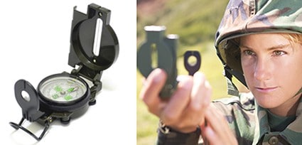
1) A lensatic compass.
2) Pencil and paper or something to record your readings.
Back home, all you will need is Google Earth loaded on your PC.
Optional, but not absolutely necessary is Google Earth or a compass APP on your phone so you know exactly where you are taking your readings.
This is a lensatic compass:
Here is a link on how to use it:
Study up on how to shoot a bearing. That is what you will be doing. Just make sure you know how to shoot a bearing. If you have not done it before, take you compass outside and practice shooting the bearing of the neighbor’s chimney, the mailbox, whatever.
Lets just say you are out scouting turkey. You hear a gobbler. Shoot a bearing and record it. I have a compass APP on my Android phone that lets me record current position– Long & Lat– and take a snapshot over a satellite map. Google Earth for Android lets you set waypoints. You can just as easily mark something down in a notebook. For the following example, all I am using is a compass and pencil and paper.
Let’s just say I’m driving along Chaney Road with the windows down, and I happen to hear a gobbler on old man Schnotthopper’s property. I stop the car, walk over to the corner fencepost and wait for the gob to gobble again. When he does, I shoot a bearing and write it down
“GOBBLER ON S-HOPPER’S FARM 88deg FROM CORNER FENCE POST
Then I roll down the road a ways. When I get to the farm house, I shoot another bearing
“BEARING 2 — 131deg FROM EDGE OF DRIVEWAY
. . . and rolling a bit more, I get to the far corner of the property
“BEARING 3 — 175deg FROM FAR CORNER FENCE POST
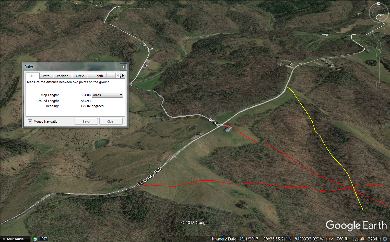
When I get home, I fire up Google Earth and click on T)ools R)uler
The Ruler function on Google Earth lets you plot a line on the map. I’ve already saved the first two plots. I’m adding the third one now.
Click on the image if you want to see it bigger.
I simply tell the Ruler to draw a line and drag the mouse in the general direction of the sound. When the Heading number matches the Bearing I want to plot, I just click the mouse.
Remember to click on the Save button after plotting each bearing. Remember too to draw the line long enough so that it runs over where you think that gobbler is roosted.
In this case, I’ve plotted my three bearing on Mr. Schnotthopper’s farm. The gobbler somewhere around where the three lines intersect. You can do it with two lines, but each bearing you take, each line you add, will probably reduce the error. Three bearings is about all you need.
Your accuracy will depend on your ability to shoot the bearings, identify your listening posts and whether or not wind or other things are bending the sound. However, on a quiet morning, I can make this work dead-on at 600 yards and walk right to the roost tree. It also helps to shoot your bearings as far apart as possible. In this instance, I was driving along the road. Out walking, I would maybe take 100 paces between shooting bearings.
This post has already been read 351 times!
Views: 2



Comments
Scouting Turkeys with Google Earth — No Comments
HTML tags allowed in your comment: <a href="" title=""> <abbr title=""> <acronym title=""> <b> <blockquote cite=""> <cite> <code> <del datetime=""> <em> <i> <q cite=""> <s> <strike> <strong>